(A post for the science geeks! And for anyone who’s curious!) After a very hesitant start, the folks at the National Oceanic and Atmospheric Administration made it official earlier this month: El Niño is here! If you remember back to my post on Why Ecuador? I’ve always wondered, what would it be like to be in the tropics, in a country heavily impacted by El Niño, during an El Niño event? El Niño is one of the reasons I’m interested in weather and climate in Ecuador.
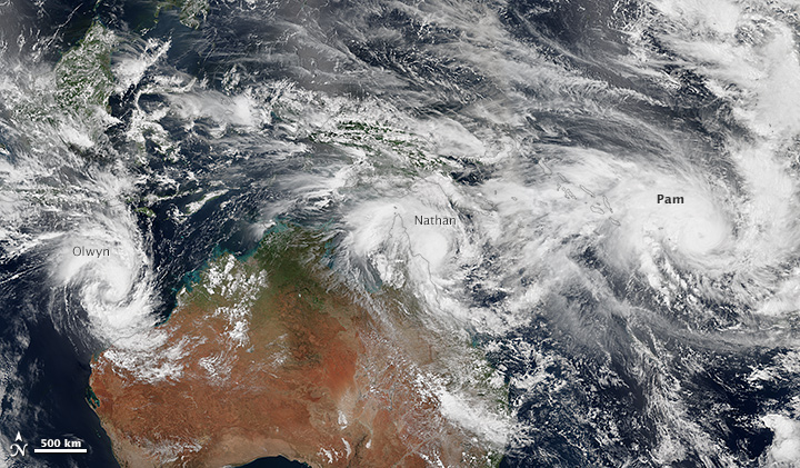
Three storms on the move in the warm waters of the Western Pacific in March 2015. This image was taken two days before Pam plowed through the island nation of Vanuatu . Warm tropical waters fuel storms like this. During El Niño, the Central-Eastern Pacific has a greater chance of seeing these types of storms (NASA image from 3/11/15).
A brief review for those of you who have heard of El Niño but need a refresher. El Niño is a periodic warming of Equatorial waters off the coast of South America. Normally, ocean waters off the coast of Peru and Ecuador are kept cool (and along the Equatorial tropical Eastern Pacific), as prevailing trade winds have the effect of moving surface ocean water away from the coast and drawing up cooler waters from the ocean depths.
During El Niño, the trade winds relax a bit, and the waters in the Eastern Pacific warm up. This happens every year from December through February, but in some years, the trade winds remain weak well beyond February – sometimes through the rest of the year. This extra ocean heat in the East Pacific promotes storm formation there, and, ultimately, has some wacky effects on weather beyond the tropics, in the same way that throwing a rock into a pond will send ripples to the other shore.
While there will certainly be no end to new stories about El Niño and it’s effects on North America, the fact is that the impacts are much bigger in Central and South America.
El Niño has the biggest impact on the coastal regions of Peru and Ecuador where the warmer ocean water off the coast provides energy for some big storms that dump lots of rain in places like Guayaquil. In the Amazon, a normally very wet place, it tends to have the opposite effect, and things dry out. Ultimately, all this depends on the ‘strength’ of the El Niño and the precise location of the warming, but the effects on the coast and the Amazon are pretty well documented.

Ocean temperature changes in the current El Niño. Interesting to note that ocean waters off the coast of South America are still quite cool.
So what does this mean for the Andean inter-mountain valleys, where I am currently residing? Well, apparently, it’s complicated. When you look at a map of the impacts of El Niño on Cuenca, for example, to the west you find more rain, to the east you find less. And right in the middle, there seems to be not much impact at all. But the fact is that there isn’t really a long record of observations here to help us understand why, or even if this ‘lack of response to El Niño’ is the same from year to year.
Also, it’s hard to generalize the high Andes when you talk about weather or climate. Every mountain valley seems to experience a different pattern of rainfall, depending on the orientation of the mountains with respect to the prevailing wind. There are very large differences from one valley to the next, even if they are only 10 miles apart. There even seem to be differences in precipitation from one neighborhood of Cuenca to another.
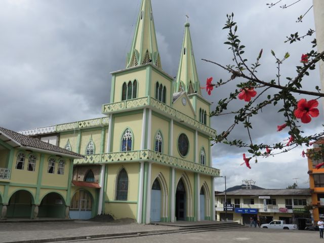
Cloudy skies over the church in the village of Chordeleg, about 45 minutes from Cuenca. Dark, heavy clouds are a common site in the Ecuadorian Andes this time of year, although there are some pretty distinct regional variations in rainfall and temperature. Chordeleg, for example, tends to be quite a bit warmer than Cuenca, on average (due to its lower elevation).
As I write this, we are coming up on the tail end of two days of rain here in Cuenca. (Not balmy tropical rain, as some of you might imagine. This is cool grab-another-sweater-its-50F Seattle-type rain.) None of the locals are checking the weather on their cell phones to see if this will continue. They just know it will. Why? Because it’s March, and this is what happens here in March. El Niño or no. It seems that if I really want to experience the effects of El Niño, I may have to travel to the coast – or even wait for a stronger El Niño. In the meantime, I can experience plenty of ‘normal’ rainfall right here in Cuenca.

Thanks for clarifying El Niño. I’ve never understood much beyond the ocean warming up, so that was interesting. Also I would have thought you’d be getting those warm tropical rains but I guess it is cooler because of your elevation? The pictures you have included in recent blogs have been great in giving us an idea of what it is like there. I can’t wait to visit one day. Thanks for letting us share your experiences. Enjoy every moment.
LikeLike